Posts

Showing posts from December, 2008

Snowstorm Dec 30

Image
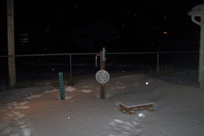
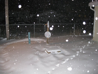
A Winter Storm Warning was in effect this morning (Dec 30). We had a quick 0.5" accumulate between 6-7am, but the band shifted northward and the snow completely stopped. Find out what went down in NW Wisconsin as the system moved east with Dirk and Derek as they actually got some good snowfall. NATIONAL WEATHER SERVICE GREEN BAY WI 1041 AM CST TUE DEC 30 2008 .UPDATE...AN UPDATED SET OF ZONES WILL BE OUT ASAP WITH THE SOUTHEAST PART OF THE FORECAST AREA DOWNGRADED FROM WARNING TO ADVISORY BASED ON EXPECTED SNOWFALL TOTALS. Oshkosh was included in the downgrade. However, the snow picked up again and since it started out as a Warning, might as well keep updating what once was, eh?! ---- Measurements (5) ---- Dec 30, 2008 @ 6:39am Light snowfall dissipating. 0.5" - New Snow 0.5" - Total Storm Snow Current Snow Depth - 7" ---- Dec 30, 2008 @ 5:01pm Moderate snow with light winds. Snow started falling again about 3pm. 1.6" - New Snow 2.1" - Total Storm Snow

Parade of Storms

Image
I got the idea for the title from Dewdrop , but I think the same idea was being used pretty much everywhere. Regardless. Simply put, that's what it's been. I suppose, since the overall pattern has changed, I would consider the parade over. The parade started back on Dec 17, ushering in system after system each producing moderate amounts of snowfall. However, this last system brought with it some very mild air and rain. OSNW3 lost several inches of snow pack with this last system. The max snowdepth during the parade hit 14" twice, back on Dec 21 and again on Dec 26. At observation time on Dec 28 the snowdepth was 7". This parade has helped many towns in the area break their all-time record snowfall for the month of December. I am confident Oshkosh's record will officially fall once the month is all said and done as well. ( OSNW3 December Observations ) ( Parade Photos ) Parade Totals (Dec 17-28) Liquid - 2.00" Snowfall - 17.7" (Temp Comparison 200

December Snowfall Record Imminent

Image
This past week was snowy and cold for the most part. Four out of the seven days OSNW3 saw accumulating snows, and on six of the seven days had min temps in the single digits with three of those six being below zero. The lowest max temp ever recorded at OSNW3 in the month of December fell on Dec 15, 7.0°, which was the first time the max temp didn't rise out of the single digits since Feb 20, 2008 when it was 9.0°, 300 days ago. Also recorded was the lowest temp ever in December at OSNW3, on Dec 21, when it dipped to -5.3°, AND, as of the 24hr observation period ending Dec 21, OSNW3 has recorded 25.7" of snowfall , which ties the official record for the month of December in Oshkosh. ( OSNW3 December Observations ) ( Accumulated Snowfall Through December ) (Temp Comparison 2007 / 2008 | Dec 1 - 21) Max temp: 26.6 / 25.3 / -1.3 Min temp: 13.7 / 7.1 / -6.6 (December 2008 Precipitation) 2008 Monthly Total Precip 1.97" Snow 25.7" Oshkosh Average Precip 1.55" S

Snowstorm - Dec 19, 2008

Image
Another Winter Storm Warning was all up ons. As the storm moved through I documented it's progress over OSNW3. During the early morning of Dec 19, a snow less hole opened up in the storm directly over Oshkosh, which I believe kept my totals on the lower side. ( radar loop / daily movie ) ---- Measurements (4) ---- Dec 19, 2008 @ 4:05am Moderate to heavy snowfall with gusty winds and blowing snow. 1.1" - New Snow 1.1" - Total Storm Snow Current Snow Depth - 7" ---- Dec 19, 2008 @ 7:10am Light snowfall with gusty winds and blowing snow. 0.8" - New Snow 1.9" - Total Storm Snow Current Snow Depth - 7" (6,7,7,9) ---- Dec 19, 2008 @ 9:14am Light to moderate snowfall with light winds. 1.4" - New Snow 3.3" - Total Storm Snow Current Snow Depth - 9" (8,9,9,11) ---- Dec 19, 2008 @ 11:16am Breezy, light blowing snow, sunshine filtering through. 0.6" - New Snow 3.9" - Total Storm Snow Current Snow Depth - 10" (9,9,10,11) ---- Seconda

First "actual" day of Winter

Image
The snowy start to December continued into this past week, dropping a good dose on Dec 8-9 , but fizzled out as the week wore on. Temps hovered below average until the system currently affecting us rolled in. Temps maxed out above freezing on Dec 13 and the precipitation that fell, fell in liquid form. Our snowpack is sustaining itself fairly well to this point... ( OSNW3 December Observations ) (Temp Comparison 2007 / 2008 | Dec 1 - 14) Max temp: 26.3 / 27.4 / +1.1 Min temp: 12.3 / 9.9 / -2.4 (December 2008 Precipitation) 2008 Monthly Total Precip 1.11" Snow 14.2" Oshkosh Average Precip 1.55" Snow 10.9" Departure Precip (0.44") Snow 3.3" ---- First "actual" day of Winter ( Defined ) Dec 10 was the official FDW at OSNW3. Last year, the FDW at OSNW3 was Dec 9 ( 2007/2008 ). Comparing this December to last, and the days preceding Winter, they seem quite similar ( 2007 / 2008 ). Congrats to DoubleJ for predicting this outcome way back on

Snowstorm - Dec 8-9, 2008

Image
The snow started falling around 3:30pm Dec 8. As the storm progressed I documented each measurement. Aftermath photos are located here . Watch the storm over it's entirety via the Storm Duration Video from OSNW3's webcam. ( radar loop ) ---- Measurements (5) ---- Dec 8, 2008 @ 9:00pm Moderate snow with light winds. Flake size is small. No sleet. 1.8" - New Snow 1.8" - Total Storm Snow Current Snow Depth - 7" ---- Dec 9, 2008 @ 1:45am Moderate snow with significant blowing snow. Flake size is small. No sleet. 2.6" - New Snow 4.4" - Total Storm Snow Current Snow Depth - 10" ---- Dec 9, 2008 @ 6:05am Light snow with minor drifting. Flake size is medium. No sleet. 0.4" - New Snow 4.8" - Total Storm Snow Current Snow Depth - 10" ---- Dec 9, 2008 @ 9:00am Light snow and mainly calm. Flake size is medium. No sleet. 1.0" - New Snow 5.8" - Total Storm Snow Current Snow Depth - 11" ---- Dec 9, 2008 @ 12:00pm Snow endi