Posts

Showing posts from March, 2008

Spring Has Arrived

Image
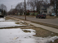
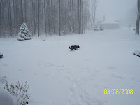
Amazingly, today, Sunday March 30th marks the "official" first day of Spring here at OSNW3. According, of course, to the " Ever Evolving Definition of Actual " for the length of a Winter Season as humbly defined by Northern Wisconsin Weather (Nathan) and myself. The exact definition I use may or may not be the same as Nathan uses to define his "actual". We'll see how it evolves! I've put my data together and generated a graphical representation of the past two Winter Seasons. ---- This past week was real quiet weather wise. The only remaining snow is the leftover removal piles or shaded areas. Our pussy willow tree is budding and the birds are getting their chirp on. The week ahead has us gearing up for big rains forecasted Monday and Tuesday with temps hovering slightly below or at average. (47-48F) (Looking West - Mar 30, 2008) (Looking East - Mar 30, 2008) ---- In the OSNW3 Daily Movie for Mar 21, 2008 it looked as if the Easter Bunny s

Down State

Image
With the impending snowstorm about to barage Southeastern Wisconsin we decided to reroute our travels to Ann Arbor and go north around Lake Michigan instead of south. ( Mackinac Bridge - Mar 21, 2008) The majority of the drive remained weather free until the snow started falling near Flint and the next thing I knew I was driving in my third snowstorm of the season. We drove through the snowstorm for an hour or more before arriving in Ann Arbor. The snow piled up throughout the day and when we reached our destination there was a few inches on the ground. (Ann Arbor, MI - Mar 21, 2008) On Saturday I spent about 10 hours helping my buddy, Ryan, plow parking lots and driveways. The temps warmed up quite a bit during the day making the snow heavy and difficult to remove. (Ann Arbor, MI - Mar 22, 2008) The ride back around the south end of Lake Michigan was mainly uneventful. Witnessing the air pollution in and around Gary, IN was fairly disturbing. I've driven this route a hand

Spring Is Near

Image
Besides the daily snow melt, March thus far has been quite inactive. Not much going on as far as Winter weather. The forecast calls for some Wintry precipitation early this week, but nothing significant for the Oshkosh area. After that, more seasonable temperatures and dry conditions. (Looking West - Mar 16, 2008) (Looking East - Mar 16, 2008) --- Athelstane Weather has an amazing webcam set up. Take a gander and click around. The webcams are everywhere. I especially enjoy the movies. Also... for the first time, I have stumbled across a NWS COOP Observer's website! Observer ID ELRW3 , in Eau Clarie, WI. I have a feeling there are many more out there, I just haven't come across them. --- I created my first webcam movie . I can't wait until next Winter. Obviously, it's still in "Demo" mode. Figuring out what software is best.

Action!

Image
Last Sunday night we got lightning and thunder with our rain! After the cold air wrapped in, OSNW3 measured 1.2" of new snowfall overnight and another inch early Monday morning bringing the storm total to 2.2" ( radar ). Action? Not so much. No lions around here. Since then it's been sunny and bright. The non-migratory birds, squirrels and rabbits are out and about looking for something eat. It's starting to feel like Spring even with day time highs below freezing and 10" of snow still on the ground. I had to depend on my Aunt who lives in Cincinnati, OH to provide the weather for this entry. They had a level 3 emergency which meant no one was allowed on the roads except emergency vehicles. It looked pretty heavy on the radar . My Aunt estimated 8-9" total on Saturday around 930am. (Cincinnati, OH - Mar 8, 2008) --- This past week I was clicking around the CoCoRaHS site and clicked on the state of Minnesota. It brought me to a pretty neat site. I

Record! (Unofficially, of course)

Image
Unofficially... Oshkosh has broken the all-time monthly snowfall for the month of February. I am excited to see the official data from the National Weather Service! Observed at OSNW3 (26.4") Official monthly record (23.8") --- Saturday morning, Mar 1, we were at my Mother & Step Father's house is Suamico, WI. I grew up here and cannot remember witnessing this much snow on the ground . So, as anyone would, I surveyed the yard for snow depth. I took 11 measurements around the perimeter of the " back yard " about 8' apart in the undisturbed snow pack. The average snow depth was 25.5" with the deepest depth measuring 26.8". This part of the yard is the furthest away from the woods. I took 5 more measurements along the " front yard " which is much closer to the woods and it averaged a snow depth of 20.2". It's not often I get to trounce around in over 2' of snow pack. It was a blast! --- I propose a silly question. &