Posts

Jack Be Nimble

Image
Extreme statistic: The observation on 1/7/18 recorded the 9th consecutive day with a daily low temperature below zero at OSNW3. All-time most since this station's genesis. If there are any questions, comments, or suggestions on the material presented please let me know. Thanks for reading!

The White Hurricane of 1913

Image
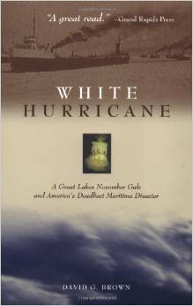
I was gifted a book this Christmas. White Hurricane: A Great Lakes November Gale and America's Deadliest Maritime Disaster by David G. Brown. Until this book was in my possession I had not known about this storm. After reading the first couple pages I decided to do a bit of research on my own before reading more. I grabbed the Oshkosh data for this time period, the Archived Daily Weather Maps and a handful of links with published material on the storm. I am anticipating this book being a great read. (Oshkosh November 1913 Climatology) --- (November 7, 1913) (November 8, 1913) (November 9, 1913) (November 10, 1913) (November 11, 1913) --- Links * The “White Hurricane” Storm of November 1913 - A Numerical Model Retrospective (my favorite) * "HELL HATH' NO FURY LIKE A GREAT LAKES FALL STORM" - William R. Deedler * The White Hurricane of 1913 - Google Images * Frozen Fury: The 1913 White Hurricane - Lake Superior Magazine * Remembering t

2014-15 Winter Divide?

Image
I do this thing that measures the length of a winter season. The criteria is simple and can be found at the link . Each winter is unique. Long, short, divided. 2014-15 is becoming special in it's own way. Earliest divide since 1994-95? If the MaxT is above 32F 12/26 and the snow depth at obs on 12/27 is < 1 inch, the 2014-15 winter will have come to a halt. 1994-95 and current 2014-15 WSD charts attached below. I have WSD data back through 1990 for Oshkosh/OSNW3. For the summaries please click here . If there are any questions, comments, or suggestions on the material presented please let me know. Thanks for reading!

2014-15 First Day of Winter

Image
The winter of 2014-15 has begun. Winter is officially here, in my backyard. Let me review the the conditions that constitute a winter season. The definition of a Winter Season Duration (WSD) is as follows, and in the case of OSNW3, six(6), is used for "several" consecutive days. First Day of Winter represents a daily max temp equal or below 32°F and a snow depth of 1" or greater for several consecutive days. Last Day of Winter represents a daily max temp equal or above 32°F and a snow depth less than 1" for several consecutive days. ---- The winter of 2014-15 began on Nov 21, 2014. Which is the earliest by 2+ weeks since 2006 . Below is a graphical representation through Dec 9, 2014. Just an FYI. The winter of 2013-14 lasted 109 days, so did the winter of 2012-13. I have WSD data back through 1990 for Oshkosh/OSNW3. For the summaries please click here . If there are any questions, comments, or suggestions on the material presented please let me k

July Summary

Image
OSNW3 July 2014 Daily Observations (click on graph for the month summary data - it will open a new tab/window) Can you name these clouds? I cannot. #lakewinnebago #neenah #wiwx pic.twitter.com/ToJdaJ4vZR — Josh Herman (@OSNW3) July 9, 2014 Top 10 coolest days in July (image). MaxT and MinT. Most recent cool MaxT Jul-28 2013. #Oshkosh #wiwx pic.twitter.com/l7SOKP0q6N — Josh Herman (@OSNW3) July 11, 2014 It is a special kind of ominous. #lakewinnebago #wiwx pic.twitter.com/x90OpBE4cu — Josh Herman (@OSNW3) July 15, 2014 Sorta fun going back and reading what I wrote during my first July blogging - http://t.co/AnOVUkMvOY - Here's to many more! #Oshkosh #wiwx — Josh Herman (@OSNW3) July 16, 2014 #OSNW3 temp records began Jan 2007. Never has the temp dropped below 50F in July. 2x now in 2014; 49.8F & 49.2F - http://t.co/HFtdYfRbXV — Josh Herman (@OSNW3) July 16, 2014 #OSNW3 has reached 90 degrees this summer. Currently 92.0°F #Oshkosh #wiwx — Josh Herman (@O

June Summary

Image
OSNW3 June 2014 Daily Observations (click on graph for the month summary data - it will open a new tab/window) #rain #Oshkosh #wiwx https://t.co/avloHIjJ2z — Josh Herman (@OSNW3) June 1, 2014 Found it a bit discouraging that the #OSNW3 #winter snowfall total didn't make the @NWSGreenBay list. pic.twitter.com/8RHNspDG26 — Josh Herman (@OSNW3) June 5, 2014 The sky above #OSNW3 #Oshkosh #wiwx pic.twitter.com/kZV06dyIA4 — Josh Herman (@OSNW3) June 15, 2014 #wiwx soul. @caseykessenich @RoyalStPatricks pic.twitter.com/JK6OdSS4oZ — Josh Herman (@OSNW3) June 19, 2014 It has been a wet decade thus far at #OSNW3 (see charts). #Oshkosh #wiwx http://t.co/QVjEtgsplf pic.twitter.com/gw2F6jKeZD — Josh Herman (@OSNW3) June 22, 2014 1.91" of #rain at #OSNW3 in #Oshkosh #wiwx . Event began at 21:32 and lasted 50-55 minutes. @LukeSampe @NWSGreenBay pic.twitter.com/f5UFYPKPKB — Josh Herman (@OSNW3) June 24, 2014 June 2014 has produced 3 days over 1 inch of pcp

May Summary

Image
OSNW3 May 2014 Daily Observations (click on graph for the month summary data - it will open a new tab/window) #OSNW3 recorded the least amount of days > 60F for Oct-Apr this decade. #Oshkosh #wiwx (more) http://t.co/MMxTNibFud pic.twitter.com/PNeeGosnaV — Josh Herman (@OSNW3) May 4, 2014 I love me some East winds. #waves on my side of #lakewinnebago #wiwx https://t.co/J5oBgkadam — Josh Herman (@OSNW3) May 7, 2014 Mr @hostalover360 , you have seen many of my FOH photos over the years. What happened to those bushes? Are they dead? pic.twitter.com/5p7YCbEVUf — Josh Herman (@OSNW3) May 13, 2014 Those dead bushes bring life to the front yard. pic.twitter.com/EDUJgbuubm — Josh Herman (@OSNW3) May 26, 2014 15 days with pcpn in May at #OSNW3 , but just 0.07" above #Oshkosh average. http://t.co/4Ankd0mbO3 #wiwx pic.twitter.com/QRB8Env2ZX — Josh Herman (@OSNW3) June 1, 2014