Posts

Showing posts from December, 2012

Major Winter Storm - Dec 19-21, 2012

Image
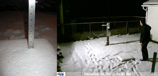
A Blizzard Warning was in effect for most of the day Thursday, Dec 20. Forecast snow totals from 9PM Dec 19 are shown below. Click image for more information from the National Weather Service Green Bay . Updates from OSNW3 are below and dated. OSNW3 Webcam . Great work, NWS GRB, the countless hours of computer model interpreting did a wonderful job predicting snow totals in Oshkosh. Total snow at OSNW3 was 12.2", forecast just hours before the snow started falling was 14.5". (Forecast Snow Totals) ---- Measurements ( 5 ) ---- Dec 21, 2012 @ 07:01 1.0" more measured at 07:01. The snow came down lightly for a few more hours after the last observation last night. The winds were strongest at OSNW3 around 11PM but haven't been that gusty since. 1.0" - New Snow 12.2" - Total Storm Snow Current Snow Depth - 9" (Dec 21, 2012 - 1.0") (Archived Radar Loop up to this Observation) ---- Dec 20, 2012 @ 20:26 2.0" more measured at 2

2012-13 Winter Season: First Inch Of Snow

Image
The Oshkosh average date for the first one inch snowfall is Dec 2. This year it occurred on Dec 9. We've been observing precipitation at OSNW3 since Nov 2006 and we've recorded a first one inch snowfall on Dec 9 twice, first time back in 2010. It is the latest date we've recorded in our six winters. Earliest date is Nov 9 which occurred last year.  All the winter "firsts and lasts" at OSNW3 can be found here . ...WINNEBAGO COUNTY... 2 WSW OMRO (752 FT)(COCORAHS)          3.9 IN OMRO - 2 SW (761 FT)(UCOOP)                3.9 IN 3 S WITTMAN FIELD (794 FT)(COCORAHS)       3.5 IN OSHKOSH 6 S (794 FT)(UCOOP)                3.5 IN 2 NNE OSHKOSH (774 FT)(COCORAHS)           2.6 IN OSHKOSH-NORTH (773 FT)(UCOOP)              2.6 IN OSHKOSH (750 FT)(COOP)                     2.0 IN NEENAH-EAST (769 FT)(UCOOP)                1.8 IN Data list for Winnebago County obtained from the NWS-GRB . More information on the storm from them can be found here . At OSNW3 we measu