Posts

Showing posts from February, 2008

Sunshine...

Image
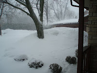
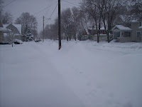
This past week we were graced with the Sun's presence everyday but Monday. Bright sunshine and seasonal temperatures with only a short lived period of clouds. This coming week, thankfully, has more snow forecasted for the area. A low pressure moving in off the California coast may bring a couple inches tomorrow night and then a Clipper system later on in the week may drop another inch. These snowfalls may help February of 2008 top the all-time snowfall for the month. Unofficially of course! Winter 2007-08 is looking good. (photo courtesy of our pal Courtney) A couple cool sites ran across my computer screen this week. From the CoCoRaHS Blog manager Chris, The Cloud Appreciation site, a NOHRSC Snow Model Time Series Quick Query Page via a Google search ( OSNW3 ), and from the "Top News of the Day" via the NWS MKE/Sullivan site the Hourly Weather Graph . It's amazing I never knew about this prior. It's a fun tool.

Forty More!

Image
February 2008 is creeping closer to 20+ inches of snowfall. If February exceeds the 20" mark, it will make each month this 07-08 Winter season , a 20+ month. I just read, however, we are some 40" away from breaking the all time record . I would love to be apart of such a Winter! (Looking West - Feb 17, 2008) (Looking East - Feb 17, 2008) Some buddies and I attended the U.P. 200 in Marquette, MI and did a small amount of " hiking " this past weekend. The city of Marquette had a noticeable shortage of snow. The locals agreed. Turns out the snow wouldn't come until we were on our way back down to WI. We drove through the heart of the snow storm . We left Marquette around 10am and arrived in Oshkosh around 4pm. It was an exhilarating drive.

CAW! CAW! CAW!

Image
As the "Mega Storm" (what some people called it) dumped feet of snow just south of OSNW3, a large flock of crows, for a moment, captured all of my attention. I need to research their behavior at this point in time (video below). It seemed as if the crows knew something "big" was happening and they gathered together to ride it out. It was painful to watch the radar during the "Mega Storm". OSNW3 received a total of only 1.9" from the "Mega Storm". Fond du lac, 15 miles south, received 9". Lake Mills, however, was directly in the thick of the snowfall. Photos taken by Chris Frey. Chris received 16" total and had to blow his driveway 4 times due to drifting. (Lake Mills, WI - Feb 7, 2008) (Lake Mills, WI - Feb 7, 2008)

February Begins

Image
The possibility is great that February could start out having a measurable snowfall five out of the first six days here at OSNW3. Today was the third out of the first four. The day started out with snow but then turned to sleet/rain by afternoon. Before the change over though, OSNW3 received 0.8" of new snow. As many around here have noticed, the 2007-2008 Winter season has been an active one. Radar Feb 1-7 . (18M) - Updated!! Observations taken at OSNW3 Seasonal Snowfall Days With Measurable Snow Looking East (Feb 2, 2008) Looking West (Feb 2, 2008)