Posts

Showing posts with the label October Climate Summary

October Summary

Image
OSNW3 October 2013 Daily Observations (click on graph for the month summary data - it will open a new tab/window) #OSNW3 ends October -0.6°F and +0.94" of #Oshkosh avg. http://t.co/qlRmFFVAxm http://t.co/2fqV9S5GeO #wiwx pic.twitter.com/fyhWkZhVmP — Josh Herman (@OSNW3) October 31, 2013 My @WPSstorm bill this month is the lowest it's been for an October bill since 2006 when it was the same, $77. #wiwx — Josh Herman (@OSNW3) October 29, 2013 Looking east. It was #sleeting as I took the photo. #lakewinnebago #clouds #wiwx pic.twitter.com/51JPx4dChC — Josh Herman (@OSNW3) October 21, 2013 #autumn at @WIBN06 pic.twitter.com/GTHghRmkz1 — Josh Herman (@OSNW3) October 19, 2013 Prior peak? Peaking? Past peak? #autumn #Neenah #wiwx pic.twitter.com/eXqvJMrzFe — Josh Herman (@OSNW3) October 14, 2013 #lakemichigan #sheboygan #wiwx https://t.co/EH1HTavwXx — Josh Herman (@OSNW3) October 11, 2013

Autumn Has Taken Hold

Image
The cool and crisp feeling of Autumn is finally being felt here at OSNW3. It took a while. We have yet to dip below the freezing mark, however. Fairly soon though we will be adding the 2011 date to the Winter History page. ( **First Freeze took place on Oct-28 ) The later it comes, the better in my opinion. Only because recent climate trends show more snow falls in winter when the first cold blast takes place a couple weeks later than average. The average first freeze in Oshkosh is Oct 12 (1981-2010). This year has more climatological posibility since it is another La Nina year. A comparison for Oshkosh winters during La Nina is below. "For the second winter in a row, La Niña will influence weather patterns across the country, but as usual, it’s not the only climate factor at play. The ‘wild card’ is the lesser-known and less predictable Arctic Oscillation that could produce dramatic short-term swings in temperatures this winter." Read more here . With that said...

Serotonin Overload?

Image
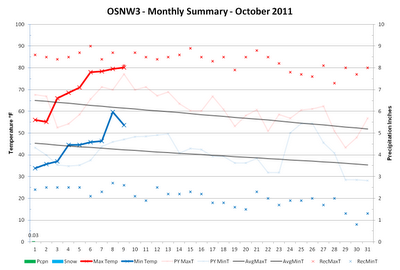
Perhaps. I've got a few cognitive symptoms: agitation (seasonal allergies), hypomania (feels like I am on the 'summer' schedule yet), mental confusion (it's autumn, right?), hallucinations (thought that was a cloud, nope, just contrails). But seriously, we haven't had a cloudy day in quite some time. As a matter of fact the first 216 hours or so of October sky observation have been mainly clear. No quantitative numbers for this statement, just my gut feel. Some numbers that are real however are the ones that describe our lack of precipitation. Only three hundredths of an inch have fallen in October and we are on pace once again to crack the top five longest dry spells at OSNW3 . With the new LRC forming we are forced to follow the computer models for a long range query. The CPC predicts a continuation of above average temperature and below average precipitation. Similar to last year at this time. In the short term however, expect a cool down with chances o...

October Climate Summary, Annual Precipitation and the LRC

Image
October of 2010 was a tranquil month with one exception, the Great Lakes Cyclone . OSNW3 ended the month 1.8 degrees above the Oshkosh mean temperature and 0.40 inches above the Oshkosh precipitation average. We recorded no snowfall. A record was broken at my location on Oct 26, when 1.14" of rainfall was recorded for the 24hr period. As for November , the near future is forecasting average temperatures with small chances of precipitation while a more mild and wet period may be awaiting us in two weeks. ( OSNW3 Weather Brief ) ( OSNW3 October Observations ) (OSNW3 October 2010 Summary) (click on graph for the month summary data - it will open a new tab/window) ---- Annual Precipitation Through October 31st, OSNW3 has recorded 35.96 inches of precipitation. Creeping ever closer to our soaking in 2008 which produced 40.86 inches of precipitation. (OSNW3 Precipitation Summary - Annual Total) (OSNW3 Precipitation Summary - Monthly Total) ---- More Winter Snowfall Outlook Jabber I h...

Historical October Weather & Post Storm Survey

Image
As we were sitting down at the dinner table on the evening of October 20th a bright flash of light entered the house followed by a loud thunderous boom. A thunderstorm in October? October hasn't produced a thunderstorm since 2007, also a La Nina year, when there were three in the first nineteen days. The rain from the thunderstorm and the persistent light rain throughout the day on the 20th brought our 17 day dry spell to an end. The dry spell ranks third all-time at OSNW3 with 19 and 21 being the top two (click here for graph). Looking ahead, things are forecast to be wetter with temps slightly above average. ( OSNW3 Weather Brief ) ( OSNW3 October Observations ) (OSNW3 October 2010 Summary) (click on graph for the month summary data - it will open a new tab/window) ---- Historical Climate Musings Karl Bohnak 's recent blog entries have stirred my curiosity. On two separate occasions this past week his insight on historical weather patterns in our region brought down the p...

October Top Ten Finish

Image
The last few days of October were no indication of what type of conditions prevailed for most of the month. Temperatures were down, and precipitation was up. Concluding the previous entry , October 2009 finishes in the top 10 for both the coolest and wettest of all-time. The active weather pattern of this October has got many thinking about what this Winter may have in store for snowfall. I am hoping for an above average season. See more details below... ( OSNW3 October Observations ) (OSNW3 October 2009 Summary) (click on graph for the complete month summary data - it will open a new tab/window) (OSNW3 Precipitation Through October 2009) (OSNW3 Misc Climate Happenings) Sunshine was scarce this October with only 19 Days with Sun and only one of those days were completely cloudless. We recorded 0 t-storms at OSNW3 in October which keeps our yearly total at 16. The monthly low temperature was overtaken this October at OSNW3 as the overnight low on Oct 11 dropped to 25.5° ( Monthl...